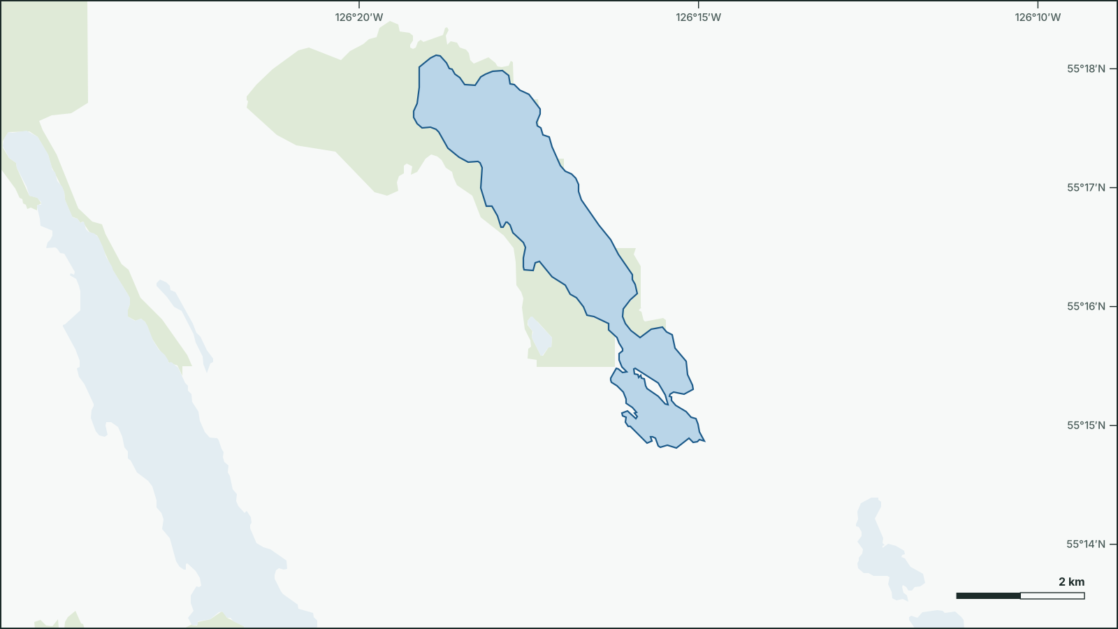
Nakinilerak Lake
55.2783° N, 126.2839° W
Shoreline and neighbouring water from open government data.
Download the map (SVG)Nakinilerak Lake, British Columbia. 55.2783° N, 126.2839° W
Not for navigation. Depths are from government surveys and may be outdated.
borealbound.ca/lakes/bc/nakinilerak-lake/, compiled October 9, 2026
- Canadian Geographical Names Database, Natural Resources Canada. Contains information licensed under the Open Government Licence – Canada.
- HydroLAKES v1.0, Messager et al. 2016 / WWF HydroSHEDS. Licensed under CC BY 4.0.
- Census boundaries and population, 2021, Statistics Canada. Adapted from Statistics Canada. This does not constitute an endorsement by Statistics Canada.
- Known BC Fish Observations and BC Fish Distributions, Government of British Columbia. Contains information licensed under the Open Government Licence – British Columbia.
- Bathymetric Maps – Open, Government of British Columbia. Contains information licensed under the Open Government Licence – British Columbia.
- Wildlife Management Units, Government of British Columbia. Contains information licensed under the Open Government Licence – British Columbia.
Nakinilerak Lake covers 7.16 km², making it larger than 94% of the 4,577 lakes in British Columbia. It lies 19 km southeast of Fort Babine.
Government surveys have recorded 10 fish species here, including lake trout, mountain whitefish and rainbow trout.
- Area
- 7.16 km²
- larger than 94% of the 4,577 lakes in British Columbia
- Shoreline
- 21.9 km
- longer than 93% of the 4,577 lakes in British Columbia
- Fish species
- 10
- more than 93% of the 2,793 surveyed lakes in British Columbia
- Elevation
- 874 m
Sun and moon today
- Civil dawn
- 7:07 a.m.
- Sunrise
- 7:43 a.m.
- Sunset
- 6:39 p.m.
- Civil dusk
- 7:16 p.m.
- Moonrise
- 6:42 a.m.
- Moonset
- 5:59 p.m.
- Moon
- Waning crescent, 1% lit
Depth
- Official government depth map (PDF)1976 survey
Not for navigation. Depths are from government surveys and may be outdated.
Fish
Sport fish by the share of the 10 government surveys (1975–1975) that recorded them.
Forage fish and other species (7)
Forage fish
- Northern Redbelly Dace 1
- Peamouth Chub 1
- Prickly Sculpin 1
- Redside Shiner 1
Other
- Largescale Sucker 1
- Longnose Sucker 1
- Northern Pikeminnow 1
Numbers are the surveys that recorded each species.
Fishing regulations: Region 7A – Omineca. Check seasons and limits before you fish.