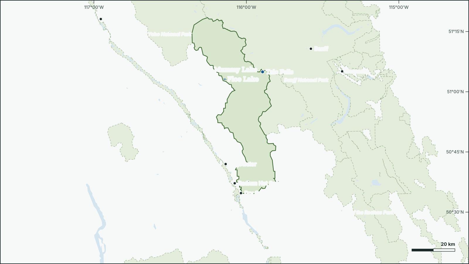
Kootenay National Park
50.942° N, 115.9874° W
Park boundary and water from open government data.
Download the map (SVG)Kootenay National Park, British Columbia. 50.942° N, 115.9874° W
National park, 1,410 km². Scale bar on the map.
borealbound.ca/parks/bc/kootenay-national-park/, compiled October 9, 2026
- Canadian Protected and Conserved Areas Database, Environment and Climate Change Canada. Contains information licensed under the Open Government Licence – Canada.
- HydroLAKES v1.0, Messager et al. 2016 / WWF HydroSHEDS. Licensed under CC BY 4.0.
- Canadian Geographical Names Database, Natural Resources Canada. Contains information licensed under the Open Government Licence – Canada.
- Census boundaries and population, 2021, Statistics Canada. Adapted from Statistics Canada. This does not constitute an endorsement by Statistics Canada.
- Parks Canada accommodation, Parks Canada Agency. Contains information licensed under the Open Government Licence – Canada.
- Parks Canada facilities, Parks Canada Agency. Contains information licensed under the Open Government Licence – Canada.
- Parks Canada trails, Parks Canada Agency. Contains information licensed under the Open Government Licence – Canada.
- City page weather forecasts and alerts, Environment and Climate Change Canada. Contains data from Environment and Climate Change Canada (ECCC Data Servers End-use Licence).
- Photographs, Wikimedia Commons contributors. Each photo carries its own licence (CC0, public domain, CC BY or CC BY-SA), credited where shown.
Kootenay National Park is a 1,410 km² national park beside Dry Gulch, in British Columbia. It was established in 1920.
4 named lakes lie in or along the park; the largest is Floe Lake (0.51 km²).
- Area
- 1,410 km²
- Established
- 1920
- Named lakes
- 4
- Trails
- 36214 km
- Campsites
- 3903 campgrounds
Conditions today
SPECIAL WEATHER STATEMENT · issued Thu 3:43 p.m. MDT
The first accumulating snow of the season is expected late this week, which may affect holiday travel.
Rain will continue to spread across northern Alberta today. Precipitation will change to snow on Friday in west-central regions, and for much of the province by Saturday.
Many areas of Alberta are expected to see accumulating snow on Saturday, possibly including the Calgary-Edmonton corridor. The highest snowfall amounts are expected in western parts of the province, including Grande Cache, Hinton, Nordegg and Rocky Mountain House where snow totals of 10 to 25 cm are currently forecast. Snow amounts for other areas of the province remain uncertain.
Snow will taper off from north to south on Sunday.
Prepare for quickly changing and deteriorating travel conditions.
Please continue to monitor alerts and forecasts issued by Environment Canada. To report severe weather, send an email to ABstorm@ec.gc.ca, call 1-800-239-0484 or post reports on social media using #ABStorm.
Official alert on weather.gc.ca · expires 7:43 a.m. MDT
15.6 °C
Observed at Banff, as of 12:00 a.m. MDT
Tonight: Becoming cloudy this evening with 30 percent chance of showers late this evening and overnight. Wind southwest 20 km/h. Low 8.
Weather: Banff (local forecast), as of 12:00 a.m. MDT
Sun and moon
- Civil dawn
- 7:24 a.m.
- Sunrise
- 7:57 a.m.
- Sunset
- 7:03 p.m.
- Civil dusk
- 7:36 p.m.
- Moonrise
- 6:55 a.m.
- Moonset
- 6:23 p.m.
- Moon
- Waning crescent, 1% lit
Follow this place by email: a weekly summary of conditions.
In the park
| Rank | Feature | Area |
|---|---|---|
| 1 | Floe Lake | 0.51 km² |
| 2 | Mummy Lake | 0.16 km² |
| 3 | Dog Lake | 0.15 km² |
| 4 | Kaufmann Lake | 0.11 km² |
Waterfalls
Official names from the Canadian Geographical Names Database; each name opens its location on OpenStreetMap.
Campgrounds
3 campgrounds have 390 campsites.
| Campground | Sites |
|---|---|
| Redstreak Campsite | 242 |
| McLeod Meadows Campsite | 88 |
| Marble Canyon Campsite | 60 |
Trails
36 named trails and routes, with 214.3 km of trail. The 15 longest are listed.
| Trail | Length |
|---|---|
| Honeymoon Pass | 16.6 km |
| Rockwall Pass | 12.4 km |
| Dolly Varden | 11.7 km |
| Floe Lake | 10.4 km |
| Helmet Creek | 10.4 km |
| Kindersley Creek | 9.9 km |
| Numa Pass | 9.8 km |
| Tokumm Valley | 9.6 km |
| Hector Gorge | 9.5 km |
| Hawk Creek | 8.9 km |
| Simpson River | 8.9 km |
| East Kootenay | 8.6 km |
| West Kootenay | 8.4 km |
| Goodsir Pass | 7.3 km |
| Tumbling Pass | 7 km |
Things to do
Camping
- Backcountry camping
- Frontcountry camping
- oTENTik
Facilities
- Hot pools
- Picnic areas
- Playground
- Trailheads
- Visitor or interpretation centre
Official record
- Designation
- National park
- IUCN category
- II, National parkInternational IUCN class, not a legal designation
- Managed by
- Parks Canada Agency
Photos

.jpg)

.jpg)

.jpg)
Names
- Parc national du Canada KootenayFrench form
Follow this place
Every Friday by email: the Environment Canada forecast and any weather alerts in effect.