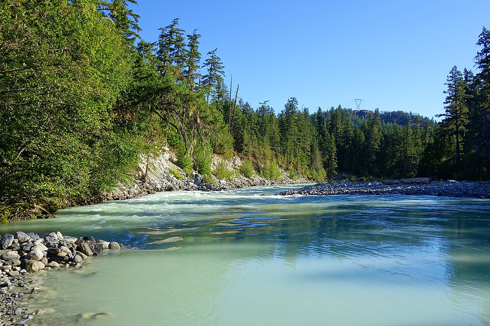
Nairn Falls Park
50.2925° N, 122.818° W
Nairn Falls Park, British Columbia. 50.2925° N, 122.818° W
Provincial park, 1.7 km². Scale bar on the map.
borealbound.ca/parks/bc/nairn-falls-park/, compiled October 9, 2026
- Canadian Protected and Conserved Areas Database, Environment and Climate Change Canada. Contains information licensed under the Open Government Licence – Canada.
- BC Parks protected areas, BC Parks. Contains information licensed under the Open Government Licence – British Columbia.
- Canadian Geographical Names Database, Natural Resources Canada. Contains information licensed under the Open Government Licence – Canada.
- Census boundaries and population, 2021, Statistics Canada. Adapted from Statistics Canada. This does not constitute an endorsement by Statistics Canada.
- City page weather forecasts and alerts, Environment and Climate Change Canada. Contains data from Environment and Climate Change Canada (ECCC Data Servers End-use Licence).
- Air Quality Health Index observations and forecasts, Environment and Climate Change Canada. Contains data from Environment and Climate Change Canada (ECCC Data Servers End-use Licence).
- Photographs, Wikimedia Commons contributors. Each photo carries its own licence (CC0, public domain, CC BY or CC BY-SA), credited where shown.
Nairn Falls Park is a 1.7 km² provincial park 1.9 km southwest of Pemberton, in British Columbia. It was established in 1966.
- Area
- 1.7 km²
- Established
- 1966
Conditions today
11.7 °C
Observed at Pemberton, as of 6:00 a.m. PDT
Today: Periods of rain ending late this morning then mainly cloudy with 60 percent chance of showers. Wind south 20 km/h gusting to 40 becoming light late this morning. High 11. UV index 2 or low.
Weather: Pemberton (local forecast), as of 6:00 a.m. PDT
Sun and moon
- Civil dawn
- 6:51 a.m.
- Sunrise
- 7:24 a.m.
- Sunset
- 6:31 p.m.
- Civil dusk
- 7:04 p.m.
- Moonrise
- 6:23 a.m.
- Moonset
- 5:51 p.m.
- Moon
- Waning crescent, 1% lit
Air Quality Health Index
2 low risk
Whistler, as of 5:00 a.m. PDT
In the park
Waterfalls
Official names from the Canadian Geographical Names Database; each name opens its location on OpenStreetMap.
Things to do
Activities
- Cycling
- E-Biking
- Fishing
- Hiking
- Pets on leash
- Wildlife viewing
Camping
- Frontcountry camping
Facilities
- Accessibility information
- Campfires
- Drinking water
- Picnic areas
- Pit or flush toilets
As listed by the park’s official page. Book a campsite
Official record
- Designation
- Provincial park
- Park class
- Class A
- IUCN category
- III, Natural monument or featureInternational IUCN class, not a legal designation
- Managed by
- Government of British Columbia
- Official website
- bcparks.ca
- Reservations
- camping.bcparks.ca
Photos