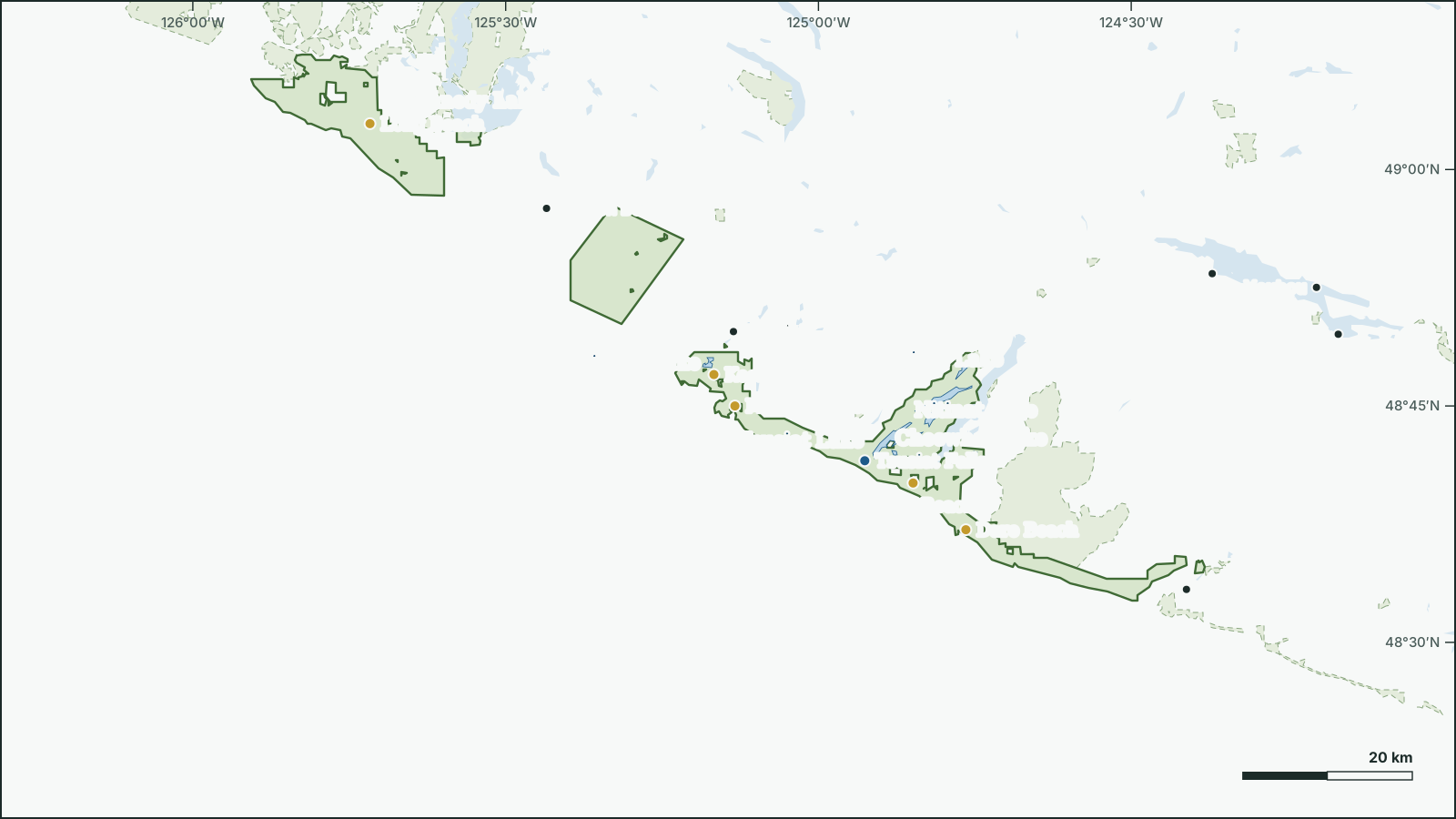
Pacific Rim National Park Reserve
49.0479° N, 125.7357° W
Park boundary and water from open government data.
Download the map (SVG)Pacific Rim National Park Reserve, British Columbia. 49.0479° N, 125.7357° W
National park, 510 km². Scale bar on the map.
borealbound.ca/parks/bc/pacific-rim-national-park-reserve/, compiled October 9, 2026
- Canadian Protected and Conserved Areas Database, Environment and Climate Change Canada. Contains information licensed under the Open Government Licence – Canada.
- HydroLAKES v1.0, Messager et al. 2016 / WWF HydroSHEDS. Licensed under CC BY 4.0.
- Canadian Geographical Names Database, Natural Resources Canada. Contains information licensed under the Open Government Licence – Canada.
- Census boundaries and population, 2021, Statistics Canada. Adapted from Statistics Canada. This does not constitute an endorsement by Statistics Canada.
- Parks Canada accommodation, Parks Canada Agency. Contains information licensed under the Open Government Licence – Canada.
- City page weather forecasts and alerts, Environment and Climate Change Canada. Contains data from Environment and Climate Change Canada (ECCC Data Servers End-use Licence).
- Photographs, Wikimedia Commons contributors. Each photo carries its own licence (CC0, public domain, CC BY or CC BY-SA), credited where shown.
Pacific Rim National Park Reserve is a 510 km² national park 1.8 km northwest of Bamfield, in British Columbia. It was established in 1970.
12 named lakes lie in or along the park; the largest is Kennedy Lake (65.3 km²).
- Area
- 510 km²
- Established
- 1970
- Named lakes
- 12
- Campsites
- 1212 campgrounds
Conditions today
13.4 °C
Observed at Tofino, as of 11:00 p.m. PDT
Tonight: Cloudy with 60 percent chance of drizzle this evening. Rain beginning late this evening. Fog patches near the coast this evening. Amount 30 mm near Zeballos and Tahsis. Wind northwest 20 km/h becoming southwest 20 gusting to 40 this evening then west 40 gusting to 60 near midnight. Low 12.
Weather: Tofino (local forecast), as of 11:02 p.m. PDT
Sun and moon
- Civil dawn
- 7:01 a.m.
- Sunrise
- 7:33 a.m.
- Sunset
- 6:46 p.m.
- Civil dusk
- 7:18 p.m.
- Moonrise
- 5:18 a.m.
- Moonset
- 5:50 p.m.
- Moon
- Waning crescent, 4% lit
Follow this place by email: a weekly summary of conditions.
In the park
| Rank | Feature | Area |
|---|---|---|
| 1 | Kennedy Lake | 65.3 km² |
| 2 | Nitinat Lake | 27 km² |
| 3 | Hobiton Lake | 3.67 km² |
| 4 | Tsusiat Lake | 3.21 km² |
| 5 | Squalicum Lake | 2.06 km² |
| 6 | Cheewhat Lake | 1.37 km² |
| 7 | Kichha Lake | 0.71 km² |
| 8 | Sprise Lake | 0.53 km² |
| 9 | Hitchie Lake | 0.42 km² |
| 10 | Tsuquadra Lake | 0.26 km² |
| 11 | Little Squalicum Lake | 0.22 km² |
| 12 | Clo-oose Lake | 0.13 km² |
Waterfalls
Official names from the Canadian Geographical Names Database; each name opens its location on OpenStreetMap.
Campgrounds
The 12 largest campgrounds have 12 campsites.
| Campground | Sites |
|---|---|
| 001 | 1 |
| 002 | 1 |
| 003 | 1 |
| 004 | 1 |
| 005 | 1 |
| 006 | 1 |
| 007 | 1 |
| 008 | 1 |
| 009 | 1 |
| 010 | 1 |
| 011 | 1 |
| 012 | 1 |
Things to do
Camping
- Backcountry camping
- Frontcountry camping
- Group camping
- oTENTik
Official record
- Designation
- National park
- IUCN category
- II, National parkInternational IUCN class, not a legal designation
- Managed by
- Parks Canada Agency
Photos


Names
- Réserve de parc national du Canada Pacific RimFrench form
Follow this place
Every Friday by email: the Environment Canada forecast and any weather alerts in effect.