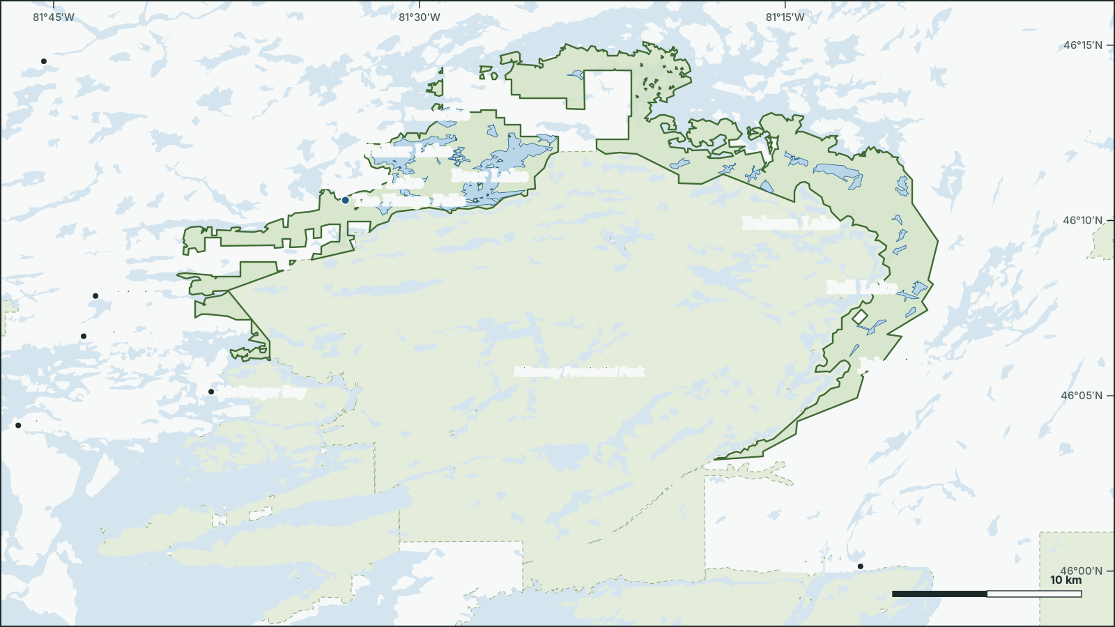
Killarney Lakelands and Headwaters Provincial Park
46.1851° N, 81.4713° W
Park boundary and water from open government data.
Download the map (SVG)Killarney Lakelands and Headwaters Provincial Park, Ontario. 46.1851° N, 81.4713° W
Provincial park, 153 km². Scale bar on the map.
borealbound.ca/parks/on/killarney-lakelands-and-headwaters-provincial-park/, compiled October 9, 2026
- Canadian Protected and Conserved Areas Database, Environment and Climate Change Canada. Contains information licensed under the Open Government Licence – Canada.
- Provincial Park and Conservation Reserve Regulated, Ontario Ministry of the Environment, Conservation and Parks. Contains information licensed under the Open Government Licence – Ontario.
- HydroLAKES v1.0, Messager et al. 2016 / WWF HydroSHEDS. Licensed under CC BY 4.0.
- Canadian Geographical Names Database, Natural Resources Canada. Contains information licensed under the Open Government Licence – Canada.
- Census boundaries and population, 2021, Statistics Canada. Adapted from Statistics Canada. This does not constitute an endorsement by Statistics Canada.
- Ontario Trail Network – Trail Segment, Ontario Ministry of Natural Resources. Contains information licensed under the Open Government Licence – Ontario.
- City page weather forecasts and alerts, Environment and Climate Change Canada. Contains data from Environment and Climate Change Canada (ECCC Data Servers End-use Licence).
- Air Quality Health Index observations and forecasts, Environment and Climate Change Canada. Contains data from Environment and Climate Change Canada (ECCC Data Servers End-use Licence).
Killarney Lakelands and Headwaters Provincial Park is a 153 km² provincial park 2.2 km northeast of McGregor Bay, in Ontario. It was established in 2006.
51 named lakes lie in or along the park; the largest is Lake Panache (83.1 km²).
- Area
- 153 km²
- Established
- 2006
- Named lakes
- 51
- Trails
- 13.5 km
Conditions today
Tonight: Partly cloudy with 30 percent chance of showers. Wind west 40 km/h gusting to 60 becoming northwest 20 gusting to 40 early this evening. Low 7.
Weather: Killarney (local forecast), as of 4:05 a.m. EDT
Sun and moon
- Civil dawn
- 7:04 a.m.
- Sunrise
- 7:35 a.m.
- Sunset
- 6:50 p.m.
- Civil dusk
- 7:20 p.m.
- Moonrise
- 6:27 a.m.
- Moonset
- 6:09 p.m.
- Moon
- Waning crescent, 1% lit
Air Quality Health Index
1 low risk
Sudbury, as of 4:00 a.m. EDT
Follow this place by email: a weekly summary of conditions.
In the park
The 12 largest of 51 named lakes, ranked by area.
| Rank | Feature | Area | Max depth |
|---|---|---|---|
| 1 | Lake Panache | 83.1 km² | 54.9 m |
| 2 | Bear Lake | 7.09 km² | 51.8 m |
| 3 | Hannah Lake | 4.8 km² | 21.3 m |
| 4 | Lang Lake | 3.97 km² | 18.3 m |
| 5 | Johnnie Lake | 3.63 km² | 30.5 m |
| 6 | Walker Lake | 3.56 km² | 54.9 m |
| 7 | Bell Lake | 3.51 km² | 24.4 m |
| 8 | Balsam Lake | 3.08 km² | |
| 9 | Frood Lake | 2.5 km² | 15.2 m |
| 10 | Carlyle Lake | 1.63 km² | 12.2 m |
| 11 | Deerhound Lake | 1.63 km² | |
| 12 | Charlton Lake | 1.59 km² | 21.3 m |
Waterfalls
Official names from the Canadian Geographical Names Database; each name opens its location on OpenStreetMap.
Trails
1 named trail or route, with 3.5 km of trail.
| Trail | Length |
|---|---|
| Lake of the Woods TrailHiking or Walking | 3.5 km |
Official record
- Designation
- Provincial park
- Park class
- Natural Environment
- IUCN category
- II, National parkInternational IUCN class, not a legal designation
- Status
- Non-operating park (no staff or visitor facilities)
- Regulated
- 2006
- Managed by
- Ontario Parks
- Official website
- ontarioparks.ca
Follow this place
Every Friday by email: the Environment Canada forecast and any weather alerts in effect.