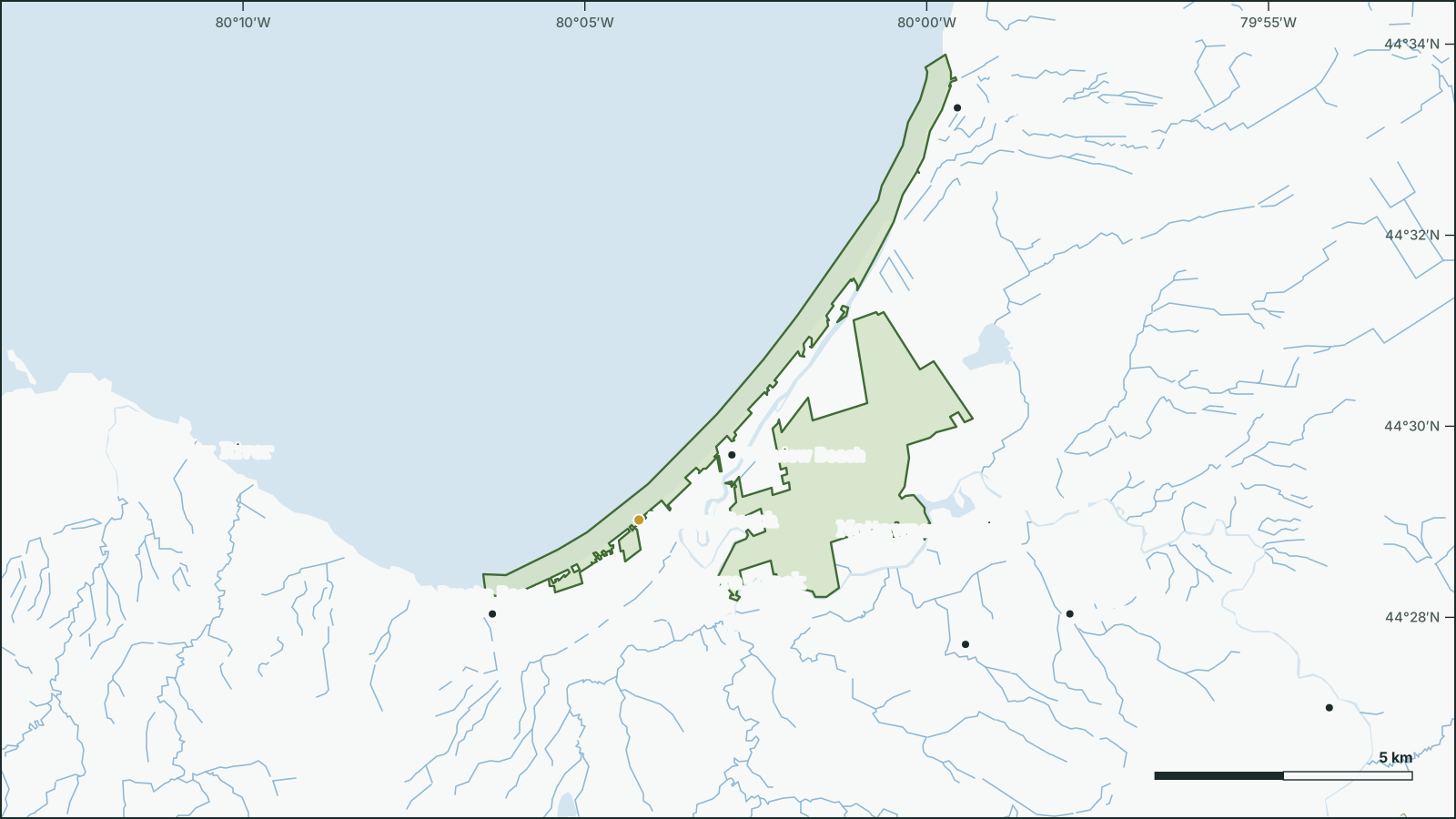
Wasaga Beach Provincial Park
44.4956° N, 80.0205° W
Park boundary and water from open government data.
Download the map (SVG)Wasaga Beach Provincial Park, Ontario. 44.4956° N, 80.0205° W
Provincial park, 18.4 km². Scale bar on the map.
borealbound.ca/parks/on/wasaga-beach-provincial-park/, compiled October 9, 2026
- Canadian Protected and Conserved Areas Database, Environment and Climate Change Canada. Contains information licensed under the Open Government Licence – Canada.
- Provincial Park and Conservation Reserve Regulated, Ontario Ministry of the Environment, Conservation and Parks. Contains information licensed under the Open Government Licence – Ontario.
- HydroLAKES v1.0, Messager et al. 2016 / WWF HydroSHEDS. Licensed under CC BY 4.0.
- Canadian Geographical Names Database, Natural Resources Canada. Contains information licensed under the Open Government Licence – Canada.
- Census boundaries and population, 2021, Statistics Canada. Adapted from Statistics Canada. This does not constitute an endorsement by Statistics Canada.
- Ontario Trail Network – Trail Segment, Ontario Ministry of Natural Resources. Contains information licensed under the Open Government Licence – Ontario.
- Visitation to Provincial Parks, Ontario Parks (Ministry of the Environment, Conservation and Parks). Contains information licensed under the Open Government Licence – Ontario.
- City page weather forecasts and alerts, Environment and Climate Change Canada. Contains data from Environment and Climate Change Canada (ECCC Data Servers End-use Licence).
- Air Quality Health Index observations and forecasts, Environment and Climate Change Canada. Contains data from Environment and Climate Change Canada (ECCC Data Servers End-use Licence).
- Photographs, Wikimedia Commons contributors. Each photo carries its own licence (CC0, public domain, CC BY or CC BY-SA), credited where shown.
Wasaga Beach Provincial Park is a 18.4 km² provincial park beside Oakview Beach, in Ontario. It was established in 1959.
2 named lakes lie in or along the park; the largest is Marl Lake (0.49 km²).
- Area
- 18.4 km²
- Established
- 1959
- Named lakes
- 2
- Trails
- 1530.5 km
- Visits 2025
- 1.3M
Conditions today
8.4 °C
Observed at Collingwood, as of 2:00 a.m. EDT
Tonight: Partly cloudy with 60 percent chance of showers. Risk of a thunderstorm early this evening. Wind northwest 30 km/h gusting to 50. Low plus 4.
Weather: Collingwood (local forecast), as of 2:00 a.m. EDT
Sun and moon
- Civil dawn
- 6:58 a.m.
- Sunrise
- 7:27 a.m.
- Sunset
- 6:46 p.m.
- Civil dusk
- 7:15 p.m.
- Moonrise
- 6:20 a.m.
- Moonset
- 6:04 p.m.
- Moon
- Waning crescent, 1% lit
Air Quality Health Index
1 low risk
Barrie, as of 1:00 a.m. EDT
Follow this place by email: a weekly summary of conditions.
In the park
| Rank | Feature | Area | Max depth |
|---|---|---|---|
| 1 | Marl Lake | 0.49 km² | |
| 2 | Jacks Lake | 0.26 km² | 1.5 m |
Beaches
Rivers
Official names from the Canadian Geographical Names Database; each name opens its location on OpenStreetMap.
Trails
15 named trails and routes, with 30.5 km of trail.
| Trail | Length |
|---|---|
| High Dunes TrailCross Country Skiing, Hiking or Walking | 4.5 km |
| Blueberry Plains TrailCross Country Skiing, Hiking or Walking | 3.9 km |
| Monument Hill TrailCross Country Skiing, Hiking or Walking | 3.3 km |
| Deer RunCross Country Skiing, Hiking or Walking | 2.8 km |
| Rabbit TrailCross Country Skiing, Hiking or Walking | 2.7 km |
| Adventure Snowshoe TrailHiking or Walking, Snowshoeing | 2.5 km |
| The Pine TrailCross Country Skiing, Hiking or Walking | 2.4 km |
| Fox RunCross Country Skiing, Hiking or Walking | 2.3 km |
| Intermediate Snowshoe TrailHiking or Walking, Snowshoeing | 1.9 km |
| Beginner Snowshoe TrailHiking or Walking, Snowshoeing | 1.5 km |
| Gill's Gultch TrailCross Country Skiing, Hiking or Walking | 1 km |
| Howland TrailCross Country Skiing, Hiking or Walking | 0.6 km |
| High Dunes Emergency AccessHiking or Walking | 0.5 km |
| Schrei SkiCross Country Skiing, Hiking or Walking | 0.4 km |
| Pine Trail ConnectionCross Country Skiing, Hiking or Walking | 0.2 km |
Visitors
1,303,621 visits were recorded in 2025.
Official record
- Designation
- Provincial park
- Park class
- Recreational
- IUCN category
- II, National parkInternational IUCN class, not a legal designation
- Status
- Operating park
- Regulated
- 2026
- Managed by
- Ontario Parks
- Official website
- ontarioparks.ca
Photos


Follow this place
Every Friday by email: the Environment Canada forecast and any weather alerts in effect.