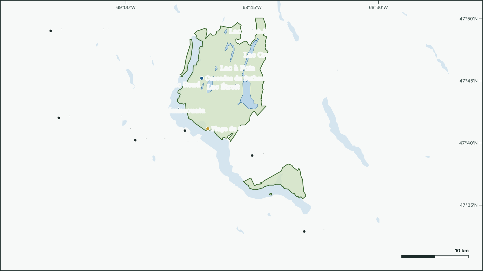
Parc national du Lac-Témiscouata
Lac-Témiscouata National Park
47.7522° N, 68.8026° W
Park boundary and water from open government data.
Download the map (SVG)Parc national du Lac-Témiscouata, Quebec. 47.7522° N, 68.8026° W
Québec national park, 177 km². Scale bar on the map.
borealbound.ca/parks/qc/parc-national-du-lac-temiscouata/, compiled October 9, 2026
- Canadian Protected and Conserved Areas Database, Environment and Climate Change Canada. Contains information licensed under the Open Government Licence – Canada.
- HydroLAKES v1.0, Messager et al. 2016 / WWF HydroSHEDS. Licensed under CC BY 4.0.
- Canadian Geographical Names Database, Natural Resources Canada. Contains information licensed under the Open Government Licence – Canada.
- Census boundaries and population, 2021, Statistics Canada. Adapted from Statistics Canada. This does not constitute an endorsement by Statistics Canada.
- SIT Québec – Nature, sports et plein air, Ministère du Tourisme du Québec. Licensed under CC BY 4.0. Source: Ministère du Tourisme du Québec, Données Québec.
- City page weather forecasts and alerts, Environment and Climate Change Canada. Contains data from Environment and Climate Change Canada (ECCC Data Servers End-use Licence).
- Air Quality Health Index observations and forecasts, Environment and Climate Change Canada. Contains data from Environment and Climate Change Canada (ECCC Data Servers End-use Licence).
- Photographs, Wikimedia Commons contributors. Each photo carries its own licence (CC0, public domain, CC BY or CC BY-SA), credited where shown.
Parc national du Lac-Témiscouata is a 177 km² québec national park 1.8 km northeast of Témiscouata-sur-le-Lac, in Quebec. It was established in 2009.
7 named lakes lie in or along the park; the largest is Lac Témiscouata (65.5 km²).
- Area
- 177 km²
- Established
- 2009
- Named lakes
- 7
Conditions today
8.5 °C
Observed at Temiscouata, as of 2:00 a.m. EDT
Tonight: A few showers ending this evening then partly cloudy. Risk of a thunderstorm early this evening. Low plus 4.
Weather: Temiscouata (local forecast), as of 2:02 a.m. EDT
Sun and moon
- Civil dawn
- 6:14 a.m.
- Sunrise
- 6:45 a.m.
- Sunset
- 5:58 p.m.
- Civil dusk
- 6:29 p.m.
- Moonrise
- 5:34 a.m.
- Moonset
- 5:16 p.m.
- Moon
- Waning crescent, 1% lit
Air Quality Health Index
1 low risk
Edmundston, as of 1:00 a.m. EDT
Follow this place by email: a weekly summary of conditions.
In the park
| Rank | Feature | Area | Max depth |
|---|---|---|---|
| 1 | Lac Témiscouata | 65.5 km² | 75.2 m |
| 2 | Grand lac Touladi | 8.15 km² | 18.3 m |
| 3 | Lac Rond | 1.52 km² | |
| 4 | Lac Croche | 0.85 km² | |
| 5 | Lac Saint-Armand | 0.16 km² | |
| 6 | Lac Étroit | 0.15 km² | |
| 7 | Lac à Foin | 0.13 km² |
Waterfalls
Beaches
Official names from the Canadian Geographical Names Database; each name opens its location on OpenStreetMap.
Things to do
Activities
- Canoe camping
- Canoeing
- Cross-country skiing
- Cycling
- Fishing
- Guided tours
- Hiking
- Kayaking
- Nature interpretation
- Pedal boating
- Sea kayaking
- Ski touring
- Snowshoeing
- Stand-up paddleboarding
- Workshops
Facilities
- Boat launch
- Convenience store
- Dogs on leash allowed
- Drinking water
- Electrical hook-ups
- Picnic areas
- Playground
- Service building
- Shop
- Toilets
- Wi-Fi
As listed by the park’s official page.
Official record
- Designation
- Québec national park
- IUCN category
- II, National parkInternational IUCN class, not a legal designation
- Managed by
- Ministère de l'Environnement, de la Lutte contre les changements climatiques, de la Faune et des Parcs, Direction des parcs
- Official website
- sepaq.com
Names
- Lac-Témiscouata National ParkEnglish form
Follow this place
Every Friday by email: the Environment Canada forecast and any weather alerts in effect.