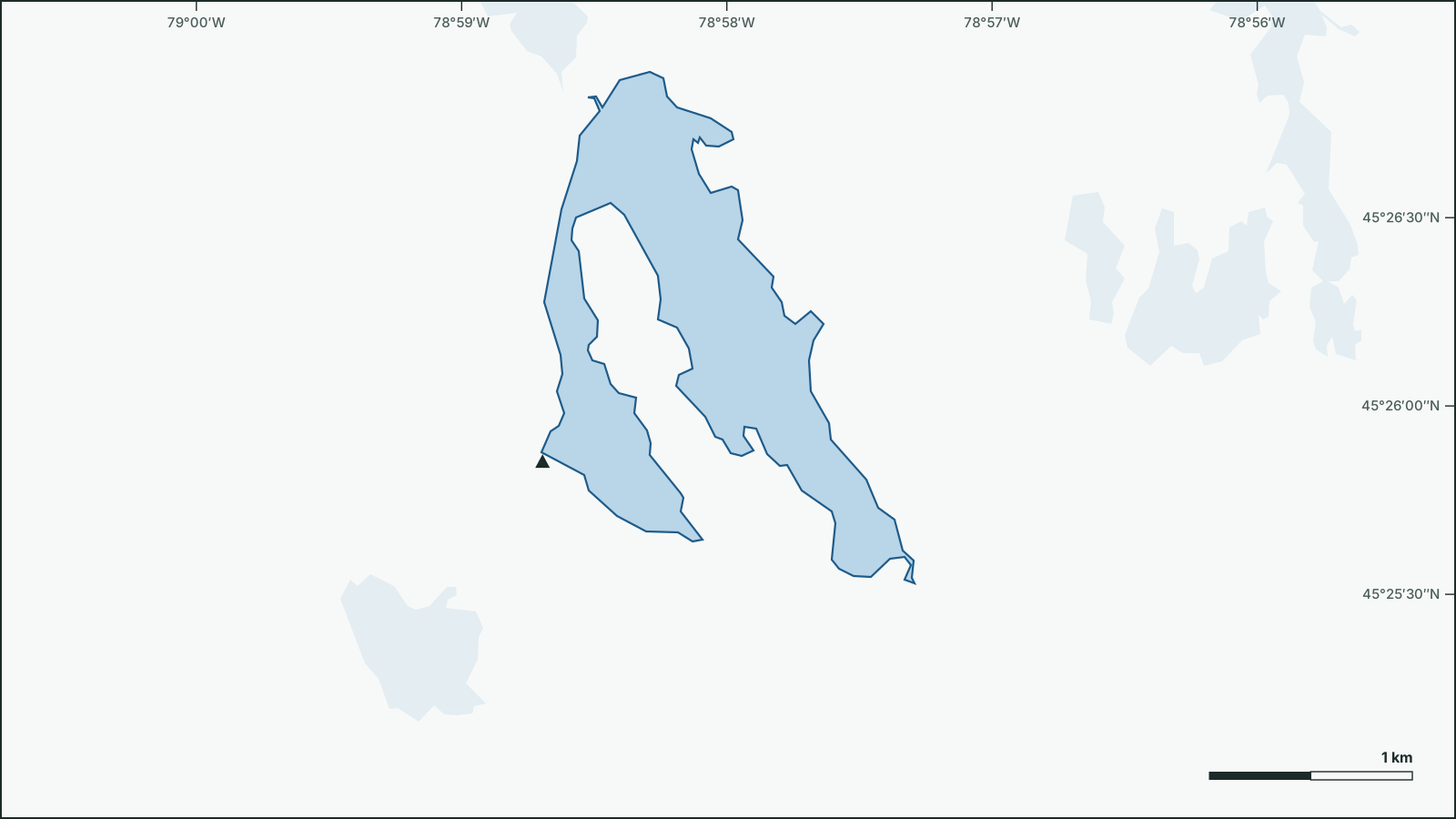
Oxbow Lake
45.4368° N, 78.9666° W
Shoreline and neighbouring water from open government data.
Download the map (SVG)Oxbow Lake, Ontario. 45.4368° N, 78.9666° W
Not for navigation. Depths are from government surveys and may be outdated.
borealbound.ca/lakes/on/oxbow-lake/, compiled October 9, 2026
- Canadian Geographical Names Database, Natural Resources Canada. Contains information licensed under the Open Government Licence – Canada.
- HydroLAKES v1.0, Messager et al. 2016 / WWF HydroSHEDS. Licensed under CC BY 4.0.
- Census boundaries and population, 2021, Statistics Canada. Adapted from Statistics Canada. This does not constitute an endorsement by Statistics Canada.
- Aquatic Resource Area survey points, Ontario Ministry of Natural Resources. Contains information licensed under the Open Government Licence – Ontario.
- Fish stocking for recreational purposes, Ontario Ministry of Natural Resources. Contains information licensed under the Open Government Licence – Ontario.
- Fishing access points, Ontario Ministry of Natural Resources. Contains information licensed under the Open Government Licence – Ontario.
- Fisheries Management Zones, Ontario Ministry of Natural Resources. Contains information licensed under the Open Government Licence – Ontario.
- Lake Partner Program, Ontario Ministry of the Environment, Conservation and Parks. Contains information licensed under the Open Government Licence – Ontario.
- City page weather forecasts and alerts, Environment and Climate Change Canada. Contains data from Environment and Climate Change Canada (ECCC Data Servers End-use Licence).
- Air Quality Health Index observations and forecasts, Environment and Climate Change Canada. Contains data from Environment and Climate Change Canada (ECCC Data Servers End-use Licence).
- Guide to Eating Ontario Fish: Advisory Database, Ontario Ministry of the Environment, Conservation and Parks. Contains information licensed under the Open Government Licence – Ontario.
Oxbow Lake covers 1.69 km², making it larger than 78% of the 18,731 lakes in Ontario. It lies 3.3 km northeast of Brooks Mill.
Government surveys have recorded 1 fish species here: lake trout.
- Area
- 1.69 km²
- larger than 78% of the 18,731 lakes in Ontario
- Shoreline
- 12.3 km
- longer than 79% of the 18,731 lakes in Ontario
- Water clarity
- 4.1 mSecchi depth, 2025
- clearer than 63% of the 1,251 monitored lakes in Ontario
- Fish species
- 1
- fewer than 100% of the 2,454 surveyed lakes in Ontario
- Elevation
- 379 m
Today on the water
4 °C
Observed at Oxtongue Lake, as of 5:00 a.m. EDT
choppy Estimated waves, next 12 hours: up to 0.3 m. Around 12 p.m., wind from the northwest: the northwest shore is sheltered, waves build toward the southeast shore.
| Time | 6 a.m. | 9 a.m. | 12 p.m. | 3 p.m. | 6 p.m. | 9 p.m. | 12 a.m. | 3 a.m. |
|---|---|---|---|---|---|---|---|---|
| Wind km/h | W 15 | W 15 | NW 30 | NW 30 | NW 15 | var. 5 | var. 5 | var. 5 |
| Gusts km/h | 50 | 50 | ||||||
| Waves (est.) m | 0.1 | 0.1 | 0.3 | 0.3 | 0.2 | |||
| Temp. °C | 3 | 5 | 9 | 12 | 11 | 6 | 1 | -2 |
| Precip. % | 40 | 40 | 40 | 20 | 20 | 0 | 0 | 0 |
Today: A mix of sun and cloud. 40 percent chance of showers this morning and early this afternoon. Wind becoming northwest 30 km/h gusting to 50 near noon. High 13. UV index 4 or moderate.
Weather: Oxtongue Lake (local forecast), as of 5:03 a.m. EDT
Sun and moon
- Civil dawn
- 6:54 a.m.
- Sunrise
- 7:24 a.m.
- Sunset
- 6:41 p.m.
- Civil dusk
- 7:10 p.m.
- Moonrise
- 6:16 a.m.
- Moonset
- 5:59 p.m.
- Moon
- Waning crescent, 1% lit
Air Quality Health Index
2 low risk
Dorset, as of 4:00 a.m. EDT
Follow this lake by email: a weekly summary of conditions.
Fish
- Lake TroutStocked
Stocking
Lake Trout1,445 fish in 5 years, most recently 2024
All stocking records (5)
| Year | Species | Fish | Stage |
|---|---|---|---|
| 2024 | Lake Trout | 245 | Yearlings |
| 2022 | Lake Trout | 300 | Yearlings |
| 2020 | Lake Trout | 300 | Yearlings |
| 2018 | Lake Trout | 300 | Yearlings |
| 2016 | Lake Trout | 300 | Yearlings |
Eating your catch
The provincial guide to eating fish (2026) sets limits for 2 species from Oxbow Lake. Maximum meals per month:
| Species | Length | General population | Sensitive population* | Contaminant |
|---|---|---|---|---|
| Lake Trout | 45-50 cm | 16 | 4 | Mercury |
| Smallmouth Bass | 35-40 cm | 8 | 4 | Mercury |
* As defined in the guide, including children and people who are or may become pregnant. Limits are for the length the guide lists most often; they change with the size of the fish. Read the official guide
Fishing regulations: Fisheries Management Zone 15. Check seasons and limits before you fish.
Water
Clarity was measured with a Secchi disk in 26 years between 1999 and 2025; the latest annual mean is 4.1 m.
Getting on the water
1 listed boat launch; 1 with parking listed. marks launches on the map.
- Boat launch
Follow this lake
Every Friday by email: the Environment Canada forecast and any weather alerts in effect.