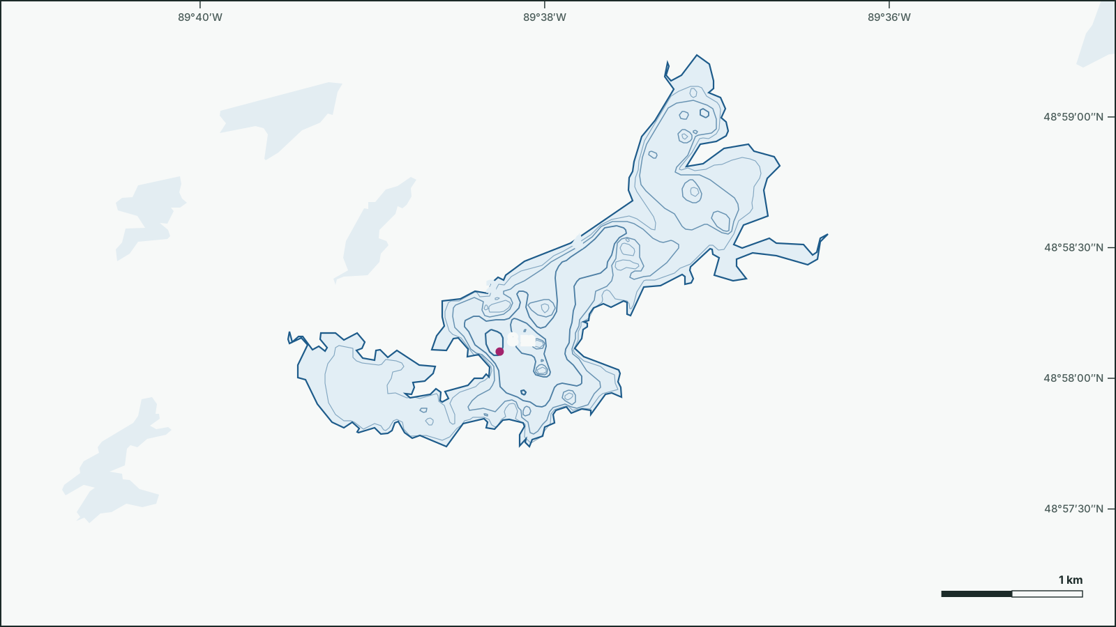
Eayrs Lake
48.9723° N, 89.6309° W
Depth contours from the 1990 government survey. Not for navigation.
Download the depth map (SVG)Eayrs Lake, Ontario. 48.9723° N, 89.6309° W
Maximum depth 8 m (1990 survey). Scale bar on the map.
Not for navigation. Depths are from government surveys and may be outdated.
borealbound.ca/lakes/on/eayrs-lake/, compiled October 9, 2026
- Canadian Geographical Names Database, Natural Resources Canada. Contains information licensed under the Open Government Licence – Canada.
- HydroLAKES v1.0, Messager et al. 2016 / WWF HydroSHEDS. Licensed under CC BY 4.0.
- Census boundaries and population, 2021, Statistics Canada. Adapted from Statistics Canada. This does not constitute an endorsement by Statistics Canada.
- Fisheries Management Zones, Ontario Ministry of Natural Resources. Contains information licensed under the Open Government Licence – Ontario.
- Bathymetry lines and survey index, Ontario Ministry of Natural Resources. Contains information licensed under the Open Government Licence – Ontario.
Eayrs Lake is 8 m deep at its deepest point, shallower than 79% of the 2,688 surveyed lakes in Ontario. It covers 2.88 km² and lies 25 km northeast of Raith.
- Maximum depth
- 8 msurveyed 1990
- shallower than 79% of the 2,688 surveyed lakes in Ontario
- Area
- 2.88 km²
- larger than 86% of the 18,731 lakes in Ontario
- Shoreline
- 18.1 km
- longer than 86% of the 18,731 lakes in Ontario
- Elevation
- 449 m
Sun and moon today
- Civil dawn
- 7:38 a.m.
- Sunrise
- 8:10 a.m.
- Sunset
- 7:20 p.m.
- Civil dusk
- 7:52 p.m.
- Moonrise
- 7:02 a.m.
- Moonset
- 6:39 p.m.
- Moon
- Waning crescent, 1% lit
Depth
How to read it: the lake’s area is sorted from the shore to the deepest point. Where the curve is flat, large areas share one depth (flats and weed beds); where it drops, depth changes quickly (drop-offs).
The government depth survey from 1990 records a maximum depth of 8 m, drawn from 39 depth contours.
- Download the depth map (SVG)Printing this page gives the map on one sheet, with scale and sources.
Not for navigation. Depths are from government surveys and may be outdated.